Hurricane Polo makes landfall in Baja California with life-threatening w…
Hurricane Polo made landfall in Baja California Sur as a Category 2 storm with 110 mph winds, bringing torrential rain and flood threats to Mexico and the U.S.
- Headline: Hurricane Polo makes landfall in Baja California with life-threatening w…
- Dispatch Summary: Hurricane Polo made landfall in Baja California Sur as a Category 2 storm with 110 mph winds, bringing torrential rain and flood threats to Mexico and the U.S.
- Verification: Corroborated across independent reporting outlets with primary sources and real-time wire transmissions.
Hurricane Polo Hits Baja California Sur with Life-Threatening Winds
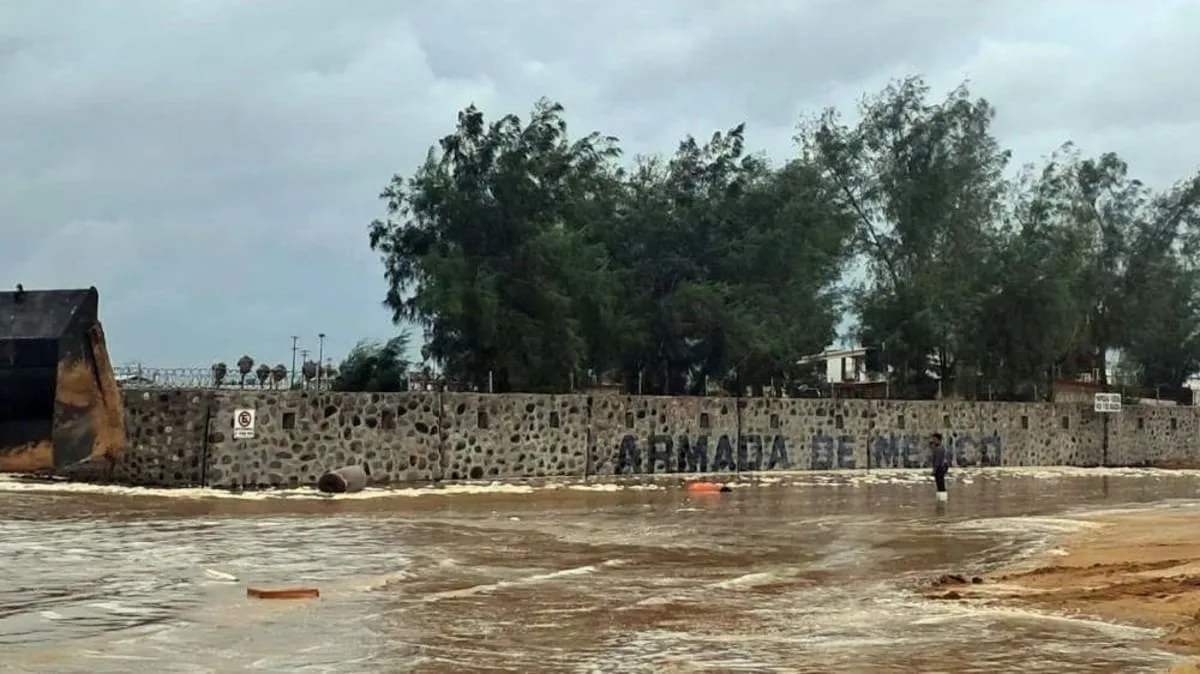
Hurricane Polo made landfall in Baja California Sur on September 28, 2026, as a Category 2 storm with maximum sustained winds of 110 mph (175 km/h), according to the U.S. National Hurricane Center (NHC). The storm struck near the village of Las Barrancas, south of Puerto San Carlos, bringing torrential rain, flash flooding, and destructive waves that overwhelmed coastal areas. Mexican authorities reported power outages and evacuated residents from low-lying regions, while shelters were opened in communities along the peninsula. The NHC described the winds as “life threatening,” emphasizing the risk of “significant coastal flooding” due to a storm surge. Waves cresting sea barriers in Puerto San Carlos and flooding in the fishing town were reported by U.S. media. Local officials in Baja California Sur urged residents to seek shelter, with shopkeeper María Palomino describing the storm as “coming with full force” as she took refuge in a high school converted into a temporary shelter.Storm’s Path and Forecasted Impacts
Polo’s trajectory is expected to carry it northeast across Baja California Sur before moving inland into the Mexican state of Sonora by Tuesday morning. While the NHC predicts some weakening as the storm traverses the peninsula, it remains forecast to retain hurricane strength upon its second landfall in mainland Mexico. The storm could dump 6–12 inches (150–300 mm) of rain across Baja California Sur, with the potential for “life-threatening flooding and mudslides, especially in areas of steep terrain,” according to the NHC. The Mexican government has suspended nonessential activities in Sonora, including school and work, and deployed military personnel to assist with evacuations and aid distribution. Ports and travel routes along the Baja California Peninsula have been closed, while the Mexican navy prepared to deliver supplies to isolated coastal communities.Regional and Cross-Border Risks
The storm’s effects are not confined to Mexico. The NHC warned that Polo’s moisture plume could trigger “significant flash flood threats” across the U.S. Southwest, including Arizona, New Mexico, and Texas. Flood watches were issued for 11 states, with forecasts of 3–6 inches of rain in the Four Corners Region and up to 8 inches in parts of Mexico. Hydrologists in Albuquerque, New Mexico, highlighted the risk of flash flooding in arid canyons and rocky landscapes, where heavy rainfall could overwhelm drainage systems. Meanwhile, the storm’s remnants are expected to influence weather patterns in the Pacific. Tropical Storm Rachel, forming off Mexico’s southern coast, is projected to strengthen into a hurricane by Wednesday. In the Hawaiian Islands, Hurricane Nolo, which had previously drenched the Big Island, is moving away from populated areas but remains a concern for marine ecosystems, including the Papahanaumokuakea Marine National Monument.El Niño’s Role in Unprecedented Storm Activity
Meteorologists attribute Polo’s intensity to the ongoing El Niño climate phenomenon, which has fueled warmer ocean temperatures and increased tropical cyclone activity in the Pacific. This year’s hurricane season has seen nine storms form in the region, including a Category 5 hurricane that briefly surpassed Polo in strength. The NHC noted that El Niño’s influence has led to “unusual” patterns, with the Pacific experiencing more frequent and powerful storms compared to the Atlantic, where no hurricanes have developed this season. Polo itself underwent “extreme rapid intensification” between September 21 and 22, with wind speeds surging from 45 mph to 150 mph in 24 hours. At its peak, the storm reached 180 mph, making it the second-strongest hurricane on record in the Eastern Pacific. Its central pressure also ranked it among the most intense storms in the region’s history.| Detail | Information |
|---|---|
| Landfall Date | September 28, 2026 |
| Wind Speed at Landfall | 110 mph (175 km/h), Category 2 |
| Maximum Rainfall Forecast | 6–12 inches (150–300 mm) in Baja California Sur |
| El Niño Influence | Warmer waters and increased cyclone activity |
| Storm Surge Risk | Significant coastal flooding with destructive waves |
Frequently Asked Questions
What is the current status of Hurricane Polo?
Hurricane Polo made landfall in Baja California Sur on September 28, 2026, as a Category 2 storm with 110 mph winds. It is moving northeast, with a forecast to maintain hurricane strength upon its second landfall in mainland Mexico’s Sonora state.
How will Polo affect the U.S. Southwest?
The storm’s moisture plume is expected to trigger flash flooding across Arizona, New Mexico, and Texas, with 3–6 inches of rain forecast. Flood watches are in effect for 11 states, including parts of the Four Corners Region and Central Plains.
What role did El Niño play in Polo’s intensity?
El Niño conditions contributed to warmer ocean temperatures, fueling Polo’s rapid intensification. The phenomenon has driven an unusually active 2026 Pacific hurricane season, with nine storms forming, including a Category 5 hurricane.
The storm’s trajectory and intensity underscore the growing challenges posed by climate-driven weather extremes. As Polo moves inland, authorities in Mexico and the U.S. Southwest will monitor its path for further impacts, while the broader implications of El Niño’s influence on hurricane patterns remain a critical area of study.
How significant is this wire dispatch?
Cast your anonymous vote to register reader consensus across journalism and intelligence sectors.
Dateline Wire is dedicated to independent, evidence-backed reporting. This briefing was synthesized from primary source reporting, corroborated across independent newsrooms, and verified against our Editorial Standards.